
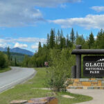
A Sneak Peek at the Park
Today was arrival day in West Glacier, and the perfect introduction to Glacier National Park. We checked into our cabin and had the rest of the day to explore the lesser-known area north of Apgar Visitor Center. We traveled up Camas Road to McDonald’s Creek Bridge, McGee’s Meadow, and an old wildfire burn site to see a few of the outstanding parts in this Park.
Click on the first photo in each group and scroll to see the square photos at full size.
To start at the beginning of this series, visit The Trip of Our Lives 2023.
En route to West Glacier, MT
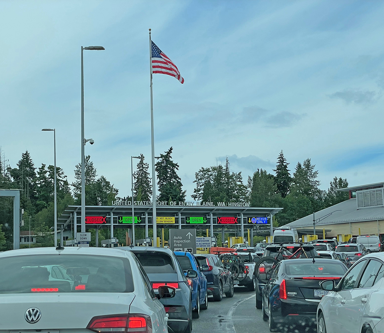 When we landed and picked up our car at YVR around midnight, we knew we wanted to get while the gettin’ was good to avoid Vancouver’s traffic in the morning. Knowing that it was going to be pretty late, we decided to stay in Surrey, BC and cross into the U.S. the next morning. The long line at the Blaine, WA port of entry made us wish we had crossed at two in the morning instead.
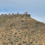
While headed to our next overnight in Spokane, I caught a glimpse of horses high up on a hill. I pulled right in to see what was going on. Turns out, the Wild Horse Monument is “a set of 15 life-size steel horses galloping across a ridge above the Columbia River”. There was a trail leading up to the monument, but since we had no time to explore any further, we enjoyed the view out over the river and then continued on down the road.
“Grandfather Cuts Loose the Ponies. Presented as a gift for the centenary of Washington’s statehood, the sculpture was conceived as a memorial to the wild horses which once roamed the region. According to the Seattle Times, it is one of the most-seen public artworks in Washington state.” ~ READ MORE
West Glacier Village
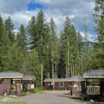
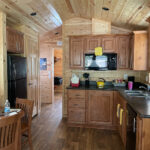
We spent the next three nights in a very nice one bedroom cabin in West Glacier Village. On a quiet path right on the edge of town, there were a couple of good restaurants and a little shopping. The best thing about our cabin was its close proximity to Glacier National Park – just six-minutes away.
Vehicle Registrations
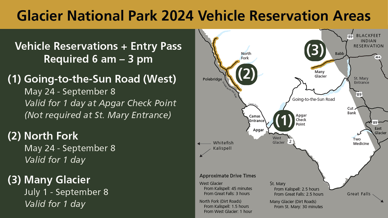 With approximately three million people visiting Glacier National Park from May-September, the park has implemented a Vehicle Registration system to limit the number of vehicles that can enter each day. Passes are required between 6am and 3pm, but are not needed for arrivals after three. A one-day pass is included for the day of a scheduled tour (with an approved tour company) or each day of a lodging reservation (inside the park).
Since we were staying just outside the park we needed a three-day pass. The earliest possible dates I could have purchased them came and went, and by the time I remembered to call they were all sold out for our dates. We knew the first day we’d be arriving after 3pm, the second day we had a scheduled boat tour, but a third pass would be nice. There are sometimes a few last-minute passes available by calling at 8am the day before, and luckily we were able to get one! Whew!
Although there is a shuttle system in the park, the season doesn’t start until July 1 – eight days after our departure. It looks like we’ll be doing all of the driving ourselves, and Jim was not too happy about one particular section!
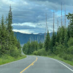
After Hours Visit: Camas Road
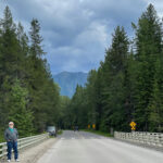
Just north of the Apgar Visitor Center, Camas Road heads north for almost 12 miles and has plenty of pullouts with beautiful overlooks. This was a perfect area for us to explore on our first day when we arrived after 3pm without a Vehicle Registration! Plus, it was absolutely beautiful and much less crowded than other parts of the park. Camas Road is located mostly within Glacier National Park and also within the boundaries of the Flathead National Forest.
“In the Rocky Mountains of Northwest Montana, just south of the Canadian border and Glacier National Park, lies the 2.4-million acre Flathead National Forest. With lakes galore, rugged wilderness, wild rivers, over 2,000 miles of trails, campgrounds, ski areas, and year-round beauty, this forest is a premiere natural landscape of the American West.” ~ READ MORE
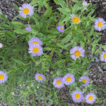
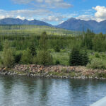
We made a stop at a bridge over McDonald Creek – a lush and lovely area with flowers and very few other visitors.
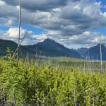
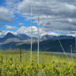
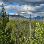
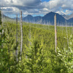
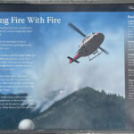
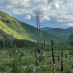
Remnants of the Robert Fire
Along the way there were plenty of pullouts with “exhibits” (information plaques) which were very helpful when we noticed a lot of white tree trunks looming above newer growth. The video below shows the remnants of the Robert Fire that burned over 57,000 acres in the summer of 2003. There is also a (very) partial view of Lake McDonald and the surrounding peaks – which were stunning.
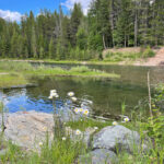
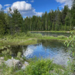
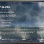
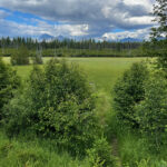
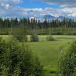
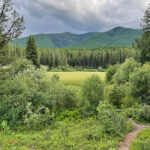
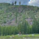
McGee Meadow
“In a place like Glacier, filled with scenic vistas and abundant wildlife, this meadow may seem unremarkable – but looks can be deceiving. McGee Meadow is actually a fen, a unique type of wetland, not a meadow at all.” ~ from the exhibit below
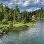
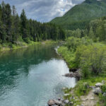
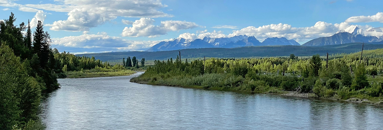
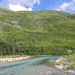
The North Fork Flathead River
“The North Fork Flathead River is a 153-mile river flowing through British Columbia, Canada, south into the U.S. state of Montana. It is one of the three primary forks of the Flathead River, the main inflow of Flathead Lake and a tributary of the Columbia River…” ~ READ MORE
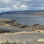
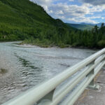
We said goodbye to Glacier National Park (temporarily) and continued on Camas Road till we came to the North Fork Flathead River. The river was so beautiful and standing on the bridge and looking out into the vastness of this place was incredible. We did a 180 to see a mountain that was carpeted in the prettiest color of green I’ve ever seen. A whole lotta swallows must have nests under the bridge, because they were having a field day near the bridge swooping around. The last photo below shows the mountain where we turned around, entered back into Glacier and headed on back to West Glacier.
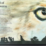
Camas Road Thwarts a Dam Proposal
“The Camas Road was constructed partly in response to a proposal to build a large dam on the North Fork of the Flathead River. Proposed by the Army Corps of Engineers and the Bureau of Reclamation, the “Glacier View Dam” would have created a reservoir covering thousands of acres of the park’s land. Park administrators hoped that by improving access and increasing visitation to the North Fork, they could prevent the construction of the dam and preserve the area’s primitive status.
Park administrators also hoped the road would provide an east-west alternative to the Going-to-the-Sun Road. Since opening in 1933, the Going-to-the-Sun Road had become the park’s most popular attraction and it was feared that increased visitor traffic would soon overwhelm the road. Administrators thought that the construction of a road into North Fork and eventually into Canada would encourage visitors to see other parts of the park…” ~ READ MORE
We grabbed a little dinner, made a quick stop at the market and headed back to our cabin. What an absolutely fabulous introduction to GNP!! There will be more tomorrow!
Next up: A Day on the GTSR
Happy trails,
Barb


