
Bridges, Blooms & Beyond
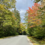
As we near the half-way point of our Bay State Getaway, we have one more day trip that covers some ground – although only half the ground we covered on our last day trip. Today we saw bridges, flowers, waterfalls, potholes, and we discovered Galumpkis. The colors are coming on nicely, which just adds to the marvelous of Massachusetts.
Since my photo galleries are messed up, please use the back button to return to the main page from each thumbnail photo.
To start at the beginning of this series, visit Bay State Getaway 2022.
The Scenic Route
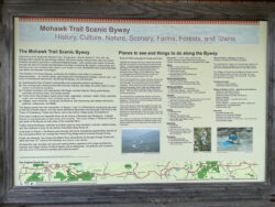 < The Mohawk Trail was designated a Scenic Byway in 1953. Route 2/2A wends its way through historic mill towns, along rushing rivers, and over scenic forested mountains and hills in northwest MA. Like a grand main street, it travels through the heart of Franklin and Berkshire Counties connecting the region’s communities and letting tourists and residents alike share in the wealth of rural, recreational and cultural activities that define the region. ~ Click on the sign to READ MORE
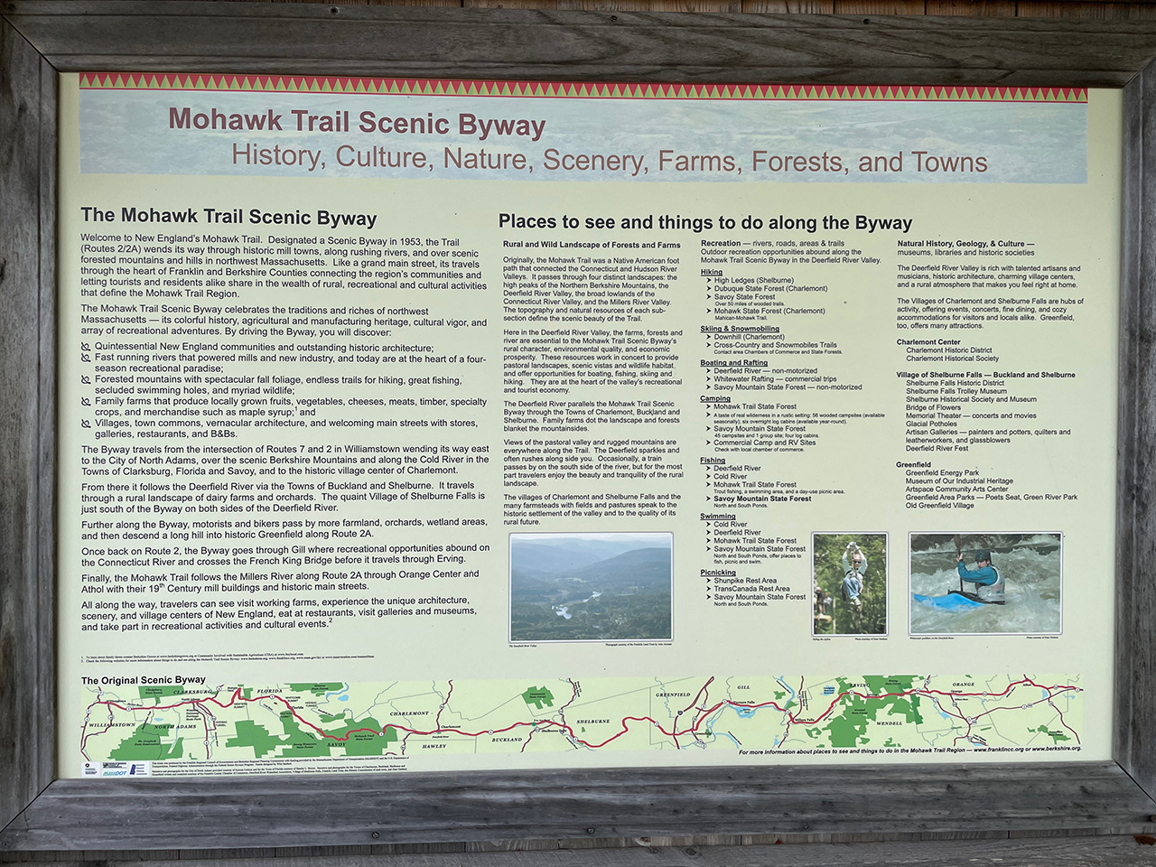
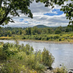
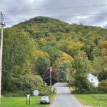
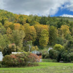
Today we spent a lot of time on the Mohawk Trail Scenic Byway (Route 2/2A). Our journey was as fantastic as our destinations – driving by several large farms in the foothills. Each had a beautiful backdrops of treed mountains, and we pulled over several times just to take it all in. With sixty-nine miles of magnificent, it turns out we were on the Mohawk Trail when we visited Natural Bridge State Park just a few days ago. Visit Day Trip to North Adams for a few photos of its stunning white marble cliffs.

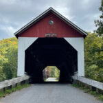
Eunice Williams Covered Bridge
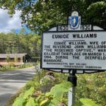
 Eunice is not a common name (although my mother’s) and the fact that her husband’s name was John (my father’s), may be why this bridge has a special place in my heart!
Once I did some research however, things got a little creepy. I know, again? My last post started out with the story of an alien encounter at our first covered bridge, and today this bridge is haunted? WTH?
I’ll let you get all of the gory details from New England Legends (click on the podcast below). If you like this kind of stuff, there are hundreds more episodes to keep you busy for a long time!
Back to the Bridge
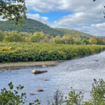
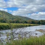
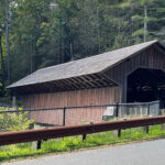
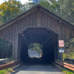
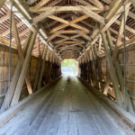
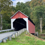
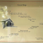
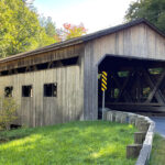
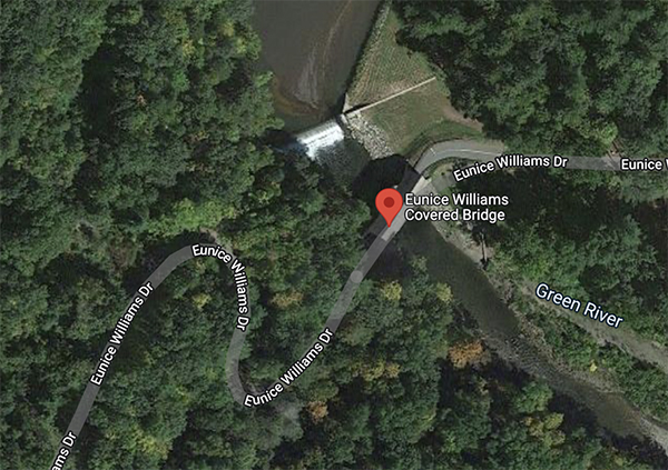 The Eunice Williams Bridge (aka Greenfield Bridge or Green River Pumping Station Bridge) carries Eunice Williams Drive over the Green River in Greenfield, MA. It is 94 feet long and only one lane wide. This bridge utilizes the Howe truss system that was invented by William Howe in 1840, and was widely used in bridges in the mid to late 1800s.
I love the way the road winds through the trees, through the clearing of the river, over the bridge, and back into the trees. With no traffic during our visit, we had the place all to ourselves and it was a wonderful, relaxing outing.
It’s Hard to Keep a Good Bridge Down
The original bridge built on this site in 1870 was destroyed almost a century later, when three young vandals out on Halloween night set it on fire. The original plans were used to build its replacement in 1972 – with a few modifications to improve its safety. Hurricane Irene wreaked havoc in 2011, but more repairs made it the beautiful bridge that it is today.
Local TV Segments
While doing my research, I stumbled upon Chronicle 5 WCVB out of Boston. This series includes YouTube videos about some of the covered bridges we visited on this trip! Visit “Haunted Covered Bridges“, “Covered Bridges Road Trip” and “Why Covered Bridges?” The commentary from the locals gives an even greater perspective of these historic bridges, and they also include some stunning photos.
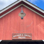
Arthur A. Smith Covered Bridge
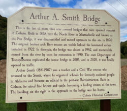 < Arthur Smith (1841-1907) was a teacher and a Civil War veteran who returned to the South, where he organized schools for formerly enslaved people in Alabama and became an official in the post-war Reconstruction. Back in Colrain, he raised fine horses and cattle, becoming a leading citizen of the town. ~ Click on the sign to READ MORE

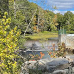
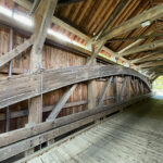
The Arthur A. Smith Bridge (aka Fox Bridge) was built in 1869 to carry Lyonsville Road across the North River in Colrain, MA – close to where it converges with Fox Brook. This site was very susceptible to flooding and the Fox Bridge was soon gravely damaged. Abandoned for nearly twenty years, the town finally voted to restore the Fox Bridge to its former glory, and in 1896 they moved it to its present location – then known as the “Arthur A. Smith Flats”.
Thanks to the fact that it was placed on abutments high above the surrounding floodplain, the bridge was only slightly damaged with Hurricane Irene’s record flooding in 2011. It is the only Burr Truss bridge in the state, and was listed on the National Register of Historic Places in 1983.
Last Covered Bridge Standing in Colrain (of 12)
The Beauty Behind the Bridge
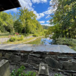
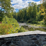
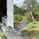
The same steep abutments that saved the bridge from sure destruction made it difficult to get to the river, and with no windows inside the bridge my river views are limited. Although the bridge itself is not all that impressive, the area surrounding it definitely is!
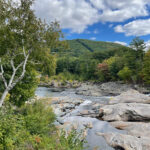
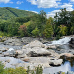
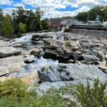
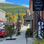
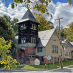
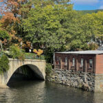
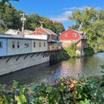
Shelburne Falls, MA
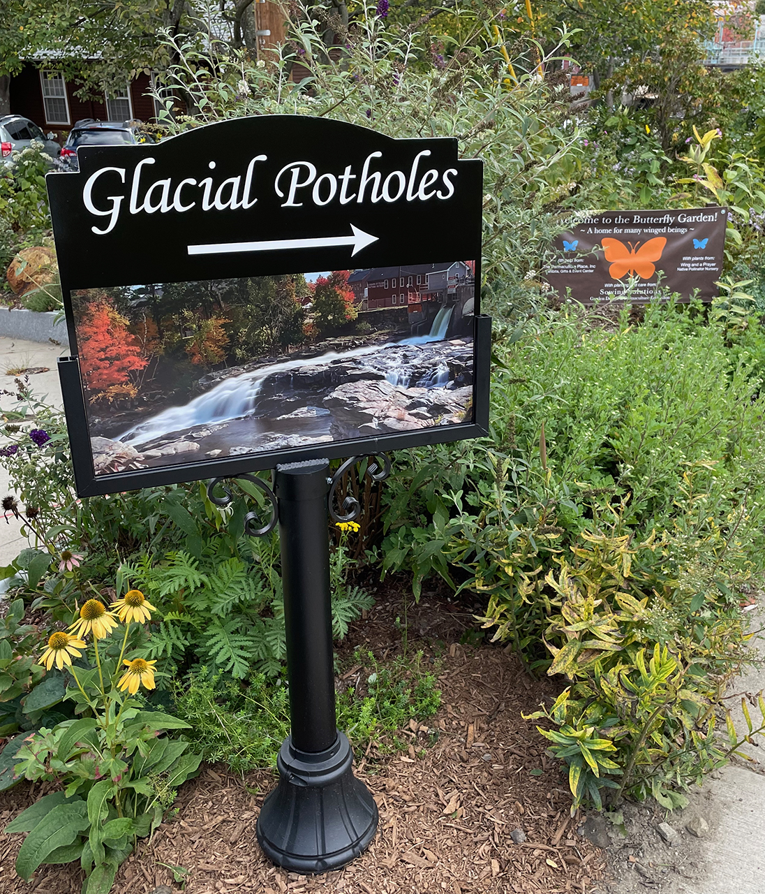
< A giant’s kettle, aka a giant’s cauldron, moulin pothole, or glacial pothole, is a typically large and cylindrical pothole drilled in solid rock underlying a glacier either by water descending down a deep moulin or by gravel rotating in the bed of subglacial meltwater stream. ~ READ MORE
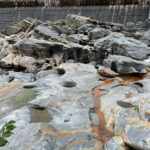
We found a great parking spot near the Glacial Potholes where we could walk to downtown Shelburne Falls. I had never really heard of potholes before (other than the ones in the roads back in Wisconsin), but have since found out about a fabulous trail fairly close to home – at the Dalles of the St. Croix. We’ll have to give that a look!
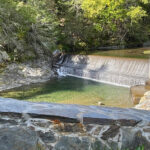
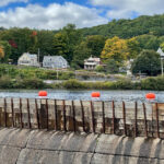
These potholes began forming after the last glacier age when the Deerfield River first started to flow over these rocks – about 14,000 years ago! They truly show the power of water as it swirled these smooth holes into solid rock.
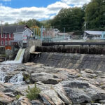
With ten hydroelectric dams along the 73 miles of the Deerfield River, it’s obvious how it got its nickname as “The Hardest Working River”. A zoomed-in photo below shows Shelburne Falls’ dam. As calm and cool as this river looks today, you should’ve seen it during Hurricane Irene in 2011. Anything but calm!

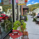
Walk About Town
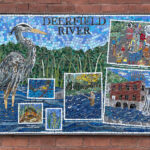
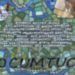
As we were doing a little window shopping, we noticed some beautiful mosaics on the sides of a couple of buildings.
Cynthia Fisher from Big Bang Mosaics is a mosaic artist from Charlemont, MA. In 2009, “she asked for the support and involvement of school officials, teachers, community leaders, and building owners” to create something special for the area she knows and loves. She also recruited local third-graders who were studying the area to come up with some content for ten mosaics – one for Shelburne Falls, plus nine other towns nearby. One, plus a closeup of another are shown below.
“The Shelburne Falls Mosaic Murals Project was a community-wide endeavor to celebrate the beauty of our rural area. Together we created ten 3′ x 3′ mosaic panels that represent our hilltowns of West County as well as two larger panels, ‘The Deerfield River’ and ‘American Indian Portrait’.” ~ READ MORE to see all of the murals in the project.
It was about time for lunch, and the Foxtown Diner looked promising. When I saw the special of the day was Galumpkis, I had to ask, “What is a Galumpki?” I’m usually not very brave, but when our waitress described an all-time favorite of mine (cabbage rolls), I was convinced. They are pictured below and were delicious!

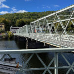
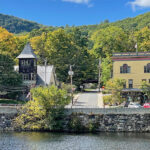
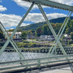
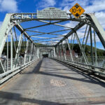
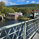
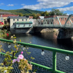
Iron Bridge
This vintage iron bridge spans the Deerfield River between the towns of Shelburne and Buckland. According to Bridgehunter.com, the bridge is a Warren through truss bridge, built in 1890 by the Vermont Construction Co. in St. Albans, VT, and renovated in 1994. As calm and cool as this river looks today, you should’ve seen it during Hurricane Irene in 2011. Anything but calm!.
“Each year on a warm August day, the Iron Bridge in Shelburne Falls is shut down and tables are set up to feed 400 hungry attendees. Linen and china span the entire bridge. Musicians stroll the bridge, serenading the diners. Athletes from the Mohawk Athletic Association serve the meal of a hearty salad, a main course, and a wonderful dessert. A portion of the proceeds from the dinner goes to the Athletic Association and the Greater Shelburne Falls Business Association. We are happy to be a part of this annual event and look forward to next year!” ~ See the YouTube Video here
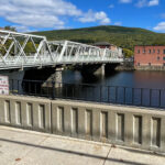
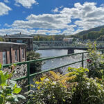
A View of Where we’re Going
It was marvelous to make the swoop through town – from our lunch stop, across the Iron Bridge over the Deerfield River, and down a short block to cross back over the river via the Bridge of Flowers. When we saw these things on googlemaps, we had no idea what to expect, but needless to say we were very pleasantly surprised!
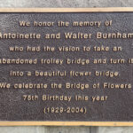
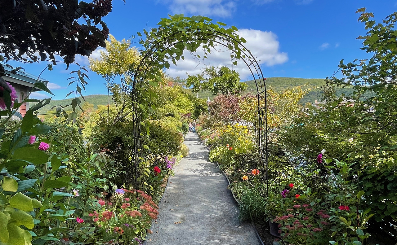
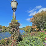
Bridge of Flowers
In 1928 the trolley was discontinued and its bridge was quickly filled in with weeds – an embarrassment – and a waste of space! The women of the town decided it could grow flowers just as well as weeds! The Women’s Club took over management and maintenance of the plantings and the first flowers were planted in 1929.
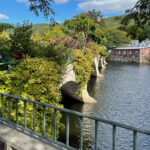

And a View of Where we’ve Been
Along with the obvious gorgeous blooms on this later-season visit (still to come), we had a birds-eye view of the river.
“Today, the Bridge of Flowers is a perfect example of a mixed border, with flowering trees, shrubs, perennials, vines, bulbs and annuals that keep the Bridge in glorious bloom from April 1 to October 30. They are cared for by the volunteer Blossom Brigade. Every year, tens of thousands of visitors from as far away as China come to admire the Bridge and take away happy memories of a small rural town with a great beauty at its heart.” ~ READ MORE


The Stars of the Show


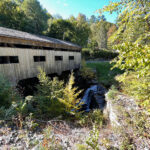
Bissell Covered Bridge
Next stop is the Bissell Covered Bridge (aka Charlemont Bridge). This bridge carries Heath Road (MA Route 8A) over Mill Brook in Charlemont (pronounced with a hard CH like Charles, rather than Sharlemont). It is 92 feet long and was the first covered bridge to be built in Massachusetts in the 20th century, replacing its predecessor which dated back to around 1881.
According to the news source I used above, the “Why Covered Bridges?” segment has great info about the turmoil that this bridge has caused over the years, and it has video of the hideous bridge that bypassed the historic one – but only for a while. Give it a watch!
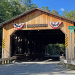
Citizen Uprisings are a Part of Massachusetts History!
“In the covered bridge world there is the “Standoff in Charlemont”. They said it is old, there are cracks in the timbers. It cannot carry modern loads. The state closed Charlemont’s historic bridge in the mid-1990s and put up a temporary bypass. The plan was to replace it with concrete and steel. But the citizens rose up in protest.
That started what ended up to be a 14-year fight over rehabilitating it vs. tearing it down. And the good guys won! The new covered bridge opened in 2004. They ended up doing it because we got thousands of signatures and petitions. An investment in their future and a nod to its past.” ~ from the video “Why Covered Bridges?“
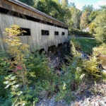
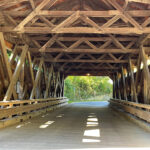
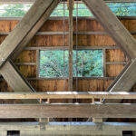
The Bones of the Bridge
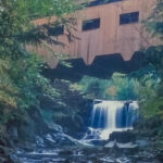
Even though the “windows” were a tad too high to get any views of the river, this could be my favorite bridge of the day. I got a terrible picture of the (very) small falls alongside the bridge, so above is a better picture that I stole from the sign with the description just below. I wish I would have thought to get a shot from that vantage point, although the falls today were considerably less voluminous.
“The bridge was sited near an old mill dam and pond not far from the house of Henry W. Bissell. The town of Charlemont appropriated $1,000 for its construction in 1880. The bridge was built in 1881. In 1951, a newer long-truss bridge was built for about $50,000 because the older bridge was deteriorated. Today’s bridge was built in 2004 to accommodate modern roadway requirements at a cost of $3 million.” ~ from a sign near the bridge
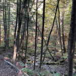
Tannery Falls
Although the trail to Tannery Falls in Savoy, MA was only a half mile, there were lots of stairs and tree limbs to navigate. In some cases the tree limbs helped with traction issues, so I guess I shouldn’t complain about those. As I was heading down, a large group of kids were heading back up and a few were huffing and puffing. I was hoping these old legs could get me back out of here, once I got down!
I took my time, took a few breathers and enjoyed my journey – even though it was a little more strenuous than our typical hike. Once I could hear the falls, I knew I was getting close. At the bottom, a woman had the right idea! She was sitting on a rock reading a book. I didn’t stay long so not to disturb her, and also because it has been a long day and I still have to climb out of here!
Oh, What a Day!
Next up: Hyde Park Overnight
Happy trails,
Barb


