
Exploring God’s Country
We’ve been looking forward to visiting the Canadian Rockies for years and finally our time has come. If Jim thought he was going to get any relaxation on this “vacation” he was sorely mistaken. Although we kept our hikes in the easy- to moderate-range, at times we thought the people rating these hikes were clearly in better shape than we are! But we did what we could, and loved every minute of it!
Since my photo galleries are messed up, please use the back button to return to the main page from each thumbnail photo.
To start at the beginning of this series, visit The Trip of Our Lives 2023.
Settling In
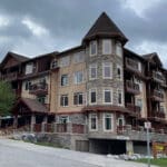
We arrived at our VRBO in Canmore, Alberta for the next four nights and immediately fell in love. If I’m being honest, we chose Canmore over Banff for our home base because things were less expensive here and Canmore looked like a really quaint town. Once we visited the town of Banff with all of its hustle and bustle, we knew we had made the right choice. Although it added another twenty minutes every time we drove north, the views were spectacular along that stretch and we never minded seeing them again (and again).
Three Sisters
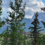
From the patio of our condo we had an obscured view of some mountains, including Little Sister (far left peak above). The trees made it difficult to see it from here, but all Three Sisters welcomed us as we ventured out everyday. And from a viewpoint just a couple minutes south, a short walk along a now-dry riverbed got us an even better view.
“In 1883, Albert Rogers named these mountains the Three Nuns after a storm left a heavy veil of snow on the northern face of all three peaks. They were renamed the Three Sisters in 1886 by George Dawson and they are referred to individually as Big Sister, Middle Sister, and Little Sister. Heavily associated with the town of Canmore in the front ranges of the Canadian Rockies known as Kananaskis Country, the Three Sisters may be the most recognized peaks in the Bow River Valley section of the TransCanada Highway (Hwy 1).” ~ READ MORE
Marble Canyon Trail
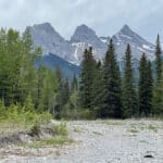
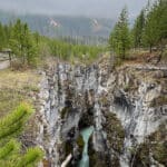
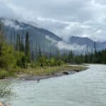
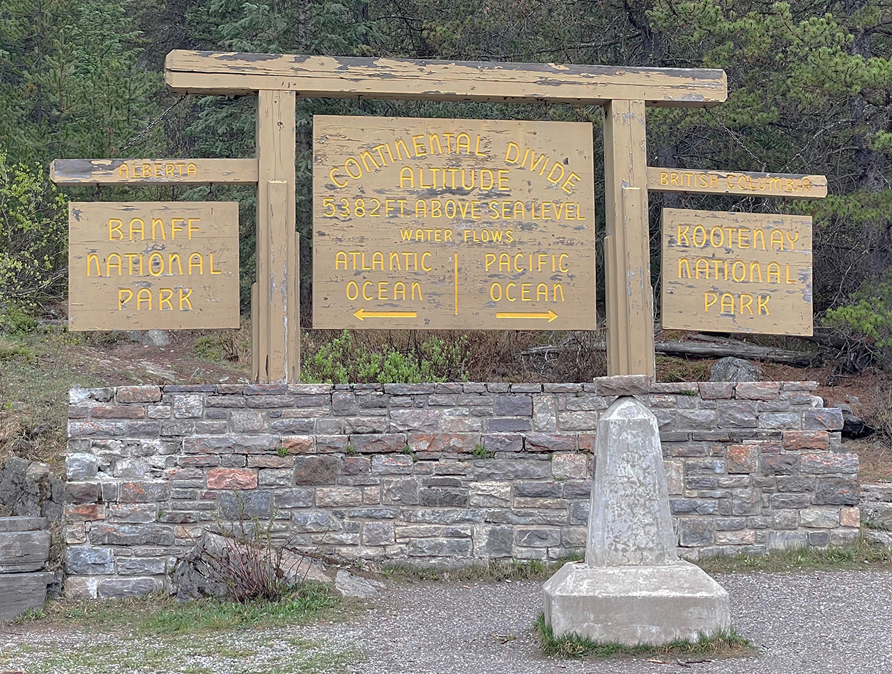 Our first day out and about took us by the Continental Divide (left) and into the north end of Kootenay National Park in the Canadian Rockies of British Columbia. Of the bevy of coats that we packed for this trip, the raincoats came out today – not because we needed them this minute, but we will be needing them at one point by the looks of that sky.
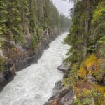
According to National Geographic, canyons “are formed by rivers making deep cuts within the Earth’s terrain.” I suppose I should have written this section in reverse since by definition, the whole process starts at the top. But we walked up the canyon and the upper river and falls were the stars of the show, so I’ll save the best for last.
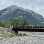
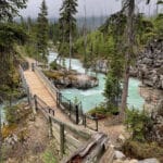
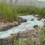
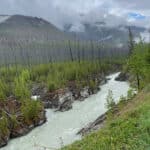
The walk along the river was just lovely with its rushing blue glacial water. The last photo looks back at the bridge we just crossed – from the first of many steps we’ll take to get up top. The bridge also gave us a bird’s eye view of the section of river fresh out of the canyon.
And the Climb Begins
We had a nice stroll by the river, but now the work begins. Although there were some steep parts, the trail was in pretty good shape if you paid attention, with plenty of rocks or roots for good footing. And, there were enough level parts for short breaks to catch our breath just when we needed them.
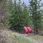
A pair of Parks Canada Red Chairs were calling our names, and they did look tempting. We decided to trudge on because the longer we took, the more drippy it got out here. We found a few more red chairs at other locations along our trip.
“Connect with nature and make memories in Canada’s most unique and treasured places. Find over 200 red Adirondack chairs [100 sets, made from 100% recycled plastic saved from Canadian landfills] placed in peaceful, breathtaking locations from coast to coast to coast. Rest, relax and discover the wonders Parks Canada has to offer.” READ MORE
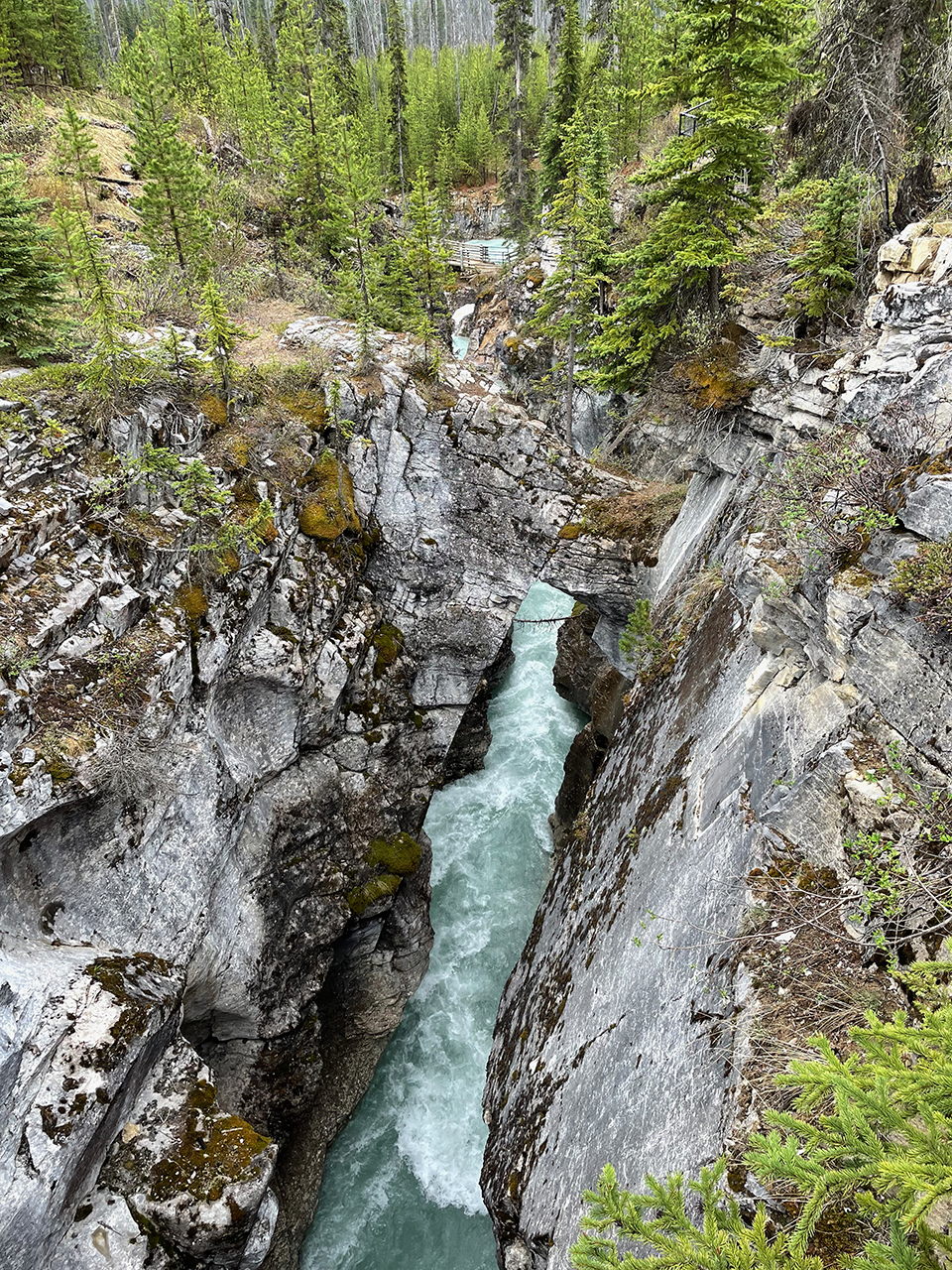
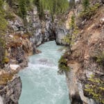
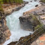
The Power of Water
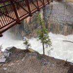
Near the top of this 1.8-mile (roundtrip) trail, it leveled out and a bridge with sturdy handrails gave us great views of the thundering falls. Unfortunately they took a sharp turn into the canyon shortly after and there was no good angle for pictures.
For the more adventurous, there’s another trail if you continue across the bridge, but that section also comes with a sign to watch for bears. Since the rain had picked up a bit, we started our decent (back down the way we came) before the trail got any more slippery. All I can say is WOW!
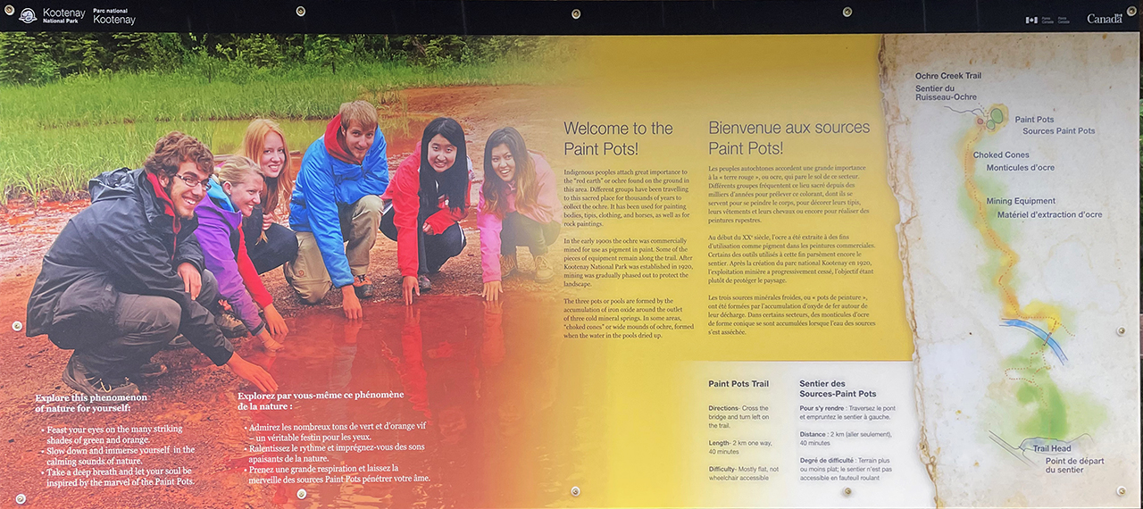
Paint Pots Trail
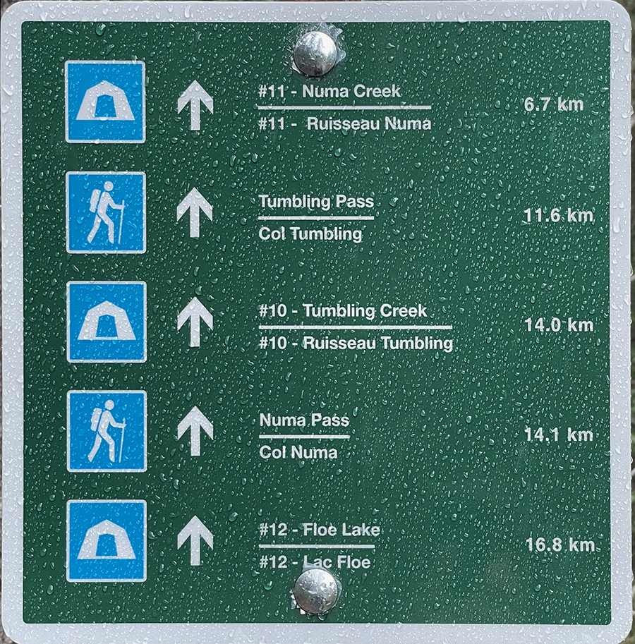
When reading about our route today and what we should not miss, the Paint Pots Trail was reviewed as amazing. On almost all of the reviews however, muddy was also indicated. We “assumed” – since by now it was full out raining – that mud would definitely be an issue. I hopped out and took a picture of the sign for future reference.
Numa Falls
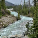
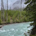
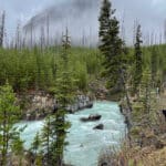
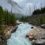
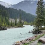
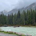
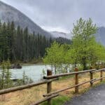
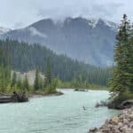
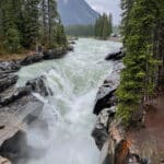
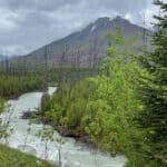
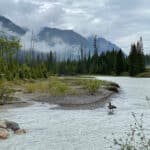
Also in Kootenay National Park, Numa Falls is located along the Banff-Windermere Highway (Kootenay Highway). The falls are easily accessed from a small parking lot and then a short and wonderful walk along the glacially fed Vermilion River. You can spot glacially fed lakes and rivers by their lovely bluish-green waters. Since there’s not a lot of sun today, the water is almost milky.
“Turquoise lakes are fed by rivers where large, active glaciers are pushing through rocky valleys upstream. The glaciers function like bulldozers, grinding away and pulverizing rocks along valley floors and walls. The process produces a fine-grained powder of silt and clay – glacial flour – that is picked up by meltwater streams. Since the particles are so fine, they are slow to sink to the bottom, remaining suspended in the water column instead.
When sunlight hits the water, these particles absorb the shortest wavelengths: the purples and indigos, and also the longer wavelength reds, oranges, and yellows. That leaves mainly blues and greens to get scattered back to our eyes.” ~ READ MORE
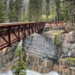
A Bridge to Trails and the Falls
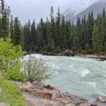
A small red bridge led us over the falls which were small, but impressive. I’m assuming this time of year they run pretty full with a steady supply of snow melt – and this rainy weather has to help as well. I’m not sure how much the glaciers come into play in this area to keep the rivers flowing all year, so I guess we’ll just have to come back in fall to find out!
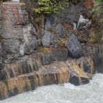
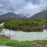
The rocks and vegetation along the banks offered stunning colors. The different layers of different colors were awesome too. Something cataclysmic happened here a LONG time ago!
The power of the river is evident here again and we’re lucky to get a breathtaking view from this beautiful (and sturdy) little bridge.
Random Stops
We tend to stop at a lot of pullouts that are marked with signs with given names, but sometimes we just stop along the road to gaze out at the beauty that surrounds us.
“There is pleasure in the pathless woods, there is rapture in the lonely shore, there is society where none intrudes, by the deep sea, and music in its roar; I love not Man the less, but Nature more.” ~ Lord Byron
Oh, What a Day!
Next up: Oh, What a Day! (cont’d)
Happy trails,
Barb


