
Exploring West Glacier, MT
This post will finish up the West Glacier side of our visit to Glacier National Park. We’ll drive along McDonald Creek in the lower elevations of the Going to the Sun Road to witness fabulous waterfalls, amazing bridges, and a peaceful walk in a forest.
Click on the first photo in each group and scroll to see the square photos at full size.
To start at the beginning of this series, visit The Trip of Our Lives 2023.
The Lower Elevations of GTSR
Earlier today we explored the upper elevations of The Going to the Sun Road up to Logan Pass. Once we reached the summit, we turned around and headed back down – saving the eastern side of the road for our visit in St. Mary, which starts tomorrow.
The inside lane was a little easier for Jim to stomach, especially since I was the one doing the driving and he could close his eyes as needed. I’m glad I don’t have an aversion to heights like he does – because those were views I wouldn’t have wanted to miss!
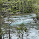
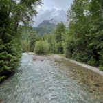
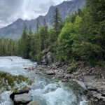
It was nice to see the sights from a different perspective on the way back down, and we stopped at a couple of pullouts for a second gawk just to get our fill. As we leveled out, McDonald Creek ran alongside us for the duration of the drive back to Lake McDonald.
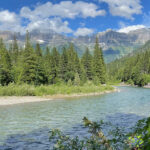
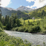
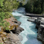
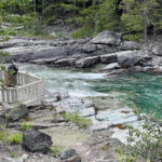
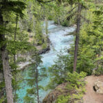
McDonald Creek Overlook
McDonald Creek Overlook had a wonderful observation deck to get us a bit closer to the churning water. I suppose they built that as a safer option to people walking out over the rocks – not that it still doesn’t happen. To see a great National Park Service video which includes the raging flood waters of 2006, visit this link.

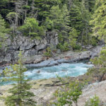
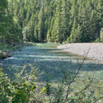
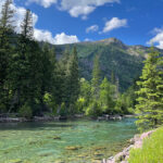
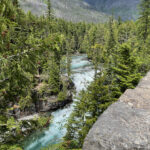
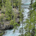
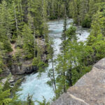
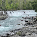
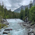
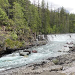
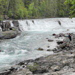
McDonald Falls
We returned the next day to finish up this side of the GTSR, and our stop at McDonald Falls was a great one! Although I think I remember stairs to get down closer to the creek, the photos below were taken when I backtracked a bit up the road to get a better perspective with fewer trees to block the view.
OK, how did those people get across the creek in the third photo? It turns out the Upper McDonald Creek Trail starts out 5.6-miles back near Lake McDonald and ends somewhere across the creek. Now that’s a commitment, especially since now they will have to turn around and go back!
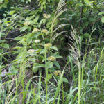
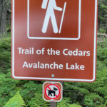
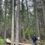
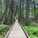
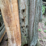
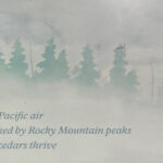
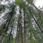
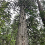
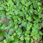
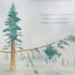
The Trail of the Cedars
Today we immersed ourselves in a cool and dense forest for the short, but sweet Trail of the Cedars loop. We walked among the old-growth cedars, hemlocks, and cottonwoods – more often found on the Pacific coast. A raised boardwalk provides wheelchair accessibility, and plenty of interpretive signs offer insight into this fantastic place. Click on the link for a great video.

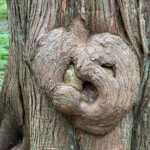
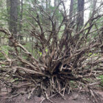
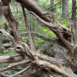
Art in Nature
The boardwalk jutted off so we could examine the root system of a huge downed tree. I thought it was beautiful and the closer I got, the more beautiful it became. Do you see the birds in the third photo, or is it just me?

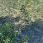
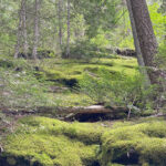
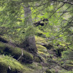
An Unlikely Habitat
Rain from clouds caught by the Continental Divide provides a habitat usually only seen on the coast of Washington or Oregon. Ancient trees loom overhead and mossy hillsides are absolutely gorgeous.
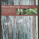
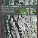

Interpretive Signs
Along with being beautiful, the interpretive signs offer great information about this particular part of Glacier National Park and the animals and plants that thrive here.
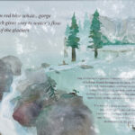

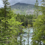
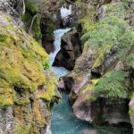
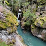
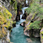
Avalanche Gorge
“Near the end of the loop trail, visitors are rewarded with a view of Avalanche Gorge. Here Avalanche Creek is funneled through a narrow gorge, where ferns and mosses decorate the ravine walls. Like a lush tropical setting, this is the payoff for a half hour walk. For those a little more ambitious, a trail climbs along the gorge and heads toward Avalanche Lake. The initial climb is the steepest part of the trail, and continues about two miles to the lake.” ~ READ MORE
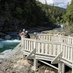
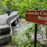
The Avalanche Creek Bridge
Since we were not up for another two-mile hike by this point in the day, we opted to head back to the car via the Avalanche Bridge. We have to save something for next time anyway, right?
“The Avalanche Creek Bridge is one of approximately seventeen prominent masonry and concrete structures on Going-to-the-Sun Road in Glacier National Park. The 51-mile stretch of scenic road is significant as a unique engineering accomplishment of the early twentieth century, and as the first product of a 1925 cooperative agreement between the National Park Service and the Bureau of Public Roads. The Avalanche Creek Bridge was built during a major reconstruction of the road in the 1930s.” ~ READ MORE
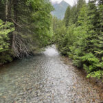
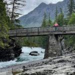
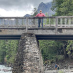
Sacred Dancing Cascade
This specific area of the Park is considered sacred by the Kootenai Indians (spelled Kootenay in British Columbia), who held ceremonies on McDonald Lake and along this creek. This was a gorgeous pullout with rapids and a short but wide falls.
A lovely horse bridge provided easy access to the other side of the creek for us and those riding horses on the Johns Lake Loop. Too bad we didn’t see any horses, or I would have my own photos instead of relying on the video at the link.
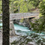

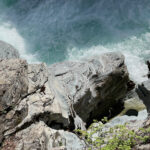
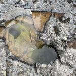
Beneath the Bridge
Smooth (and dry) black rock made it easy to walk out close to the water to examine its glacial potholes and get low-level photos of the falls without obstructions. Jim had a little fun posing up top on the beautiful bridge.
Long Day, So Much Beauty!
Since it was right around the corner from our West Glacier Cabin, we decided on the Glacial Highland Restaurant for an awesome dinner. Tomorrow is moving day, so it’s time to get packed up! We are totally impressed by Glacier National Park and we’ve only seen a small portion. Another beautiful day is on tap for tomorrow!
Next up: En route to St. Mary Village
Happy trails,
Barb


