
A Sweet Route on Moving Day
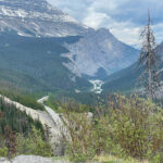
Today we transitioned from our home base in Canmore to Jasper along the Icefields Parkway – a pretty sweet route! As moving days go, this was definitely one of our best – with more glacial lakes, mountain views, waterfalls, and the Athabasca Glacier.
Since my photo galleries are messed up, please use the back button to return to the main page from each thumbnail photo.
To start at the beginning of this series, visit The Trip of Our Lives 2023.
Linking Lake Louise with Jasper, Alberta is one of the most beautiful journeys on the planet. Rated as one of the top drives in the world by Condé Nast Traveller, the Icefield Parkway is a 232 km (144 mile) stretch of double-lane highway winding along the Continental Divide through soaring rocky mountain peaks, icefields and vast sweeping valleys. ~ READ MORE
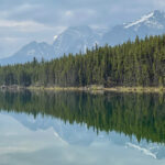
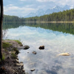
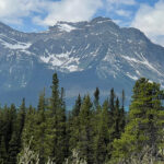
Herbert Lake
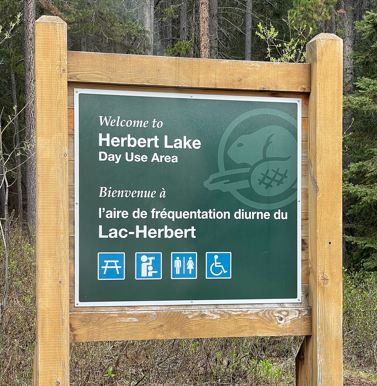 Just north of Lake Louise – shortly after the Trans-Canada Highway heads west and we continued north on 93 – we arrived at Herbert Lake. This was a lovely little lake, and no matter how many times I see every little detail from the scene above reflected in the water below (without using an app or a filter) – I swoon. I suppose you’ve noticed that by now!
Although the one-mile loop around the lake would have been an easy one, we decided to just make this a quick stop for photos. It was a little muddy and we’ve got lots to see today!
“The Herbert Lake hike is a short loop around a beautiful roadside lake. Often bypassed by those driving the Icefields Parkway, the Herbert Lake trail is a wonderful way to stretch your legs, walk the dog, and hop in for a swim!” ~ READ MORE
Crowfoot Glacier
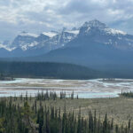
Just before the Glacier Viewpoint, we knew we were getting close when we could see a sliver of the emerald waters of Bow Lake at the base of a mountain.
“Attached to the northeastern side of Crowfoot Mountain, overlooking Bow Lake, the glacier’s runoff feeds into the Bow River, which flows from Banff National Park through the City of Calgary to the Alberta prairies.” ~ READ MORE
Since we were new to glaciers, it took us a while to know what we were looking for, but when the sun hit the mountain on the upper-left, it drew our attention to that area. The last photo was taken from a slightly different angle a little further down the road. It’s a much better angle to see the snow piled higher to look more glacier-like.
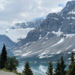
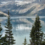
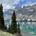
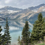
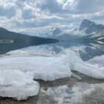
Bow Lake
As much as I hate the fact that the glaciers are melting at an alarming rate, I feel incredibly blessed to see the glacial rivers and lakes we’ve seen on this trip so far. What a phenomenal process it is that turns the waters such an amazing color. In case you missed it before, there’s a great explanation under the Numa Falls section in Exploring God’s Country.
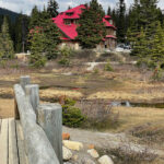
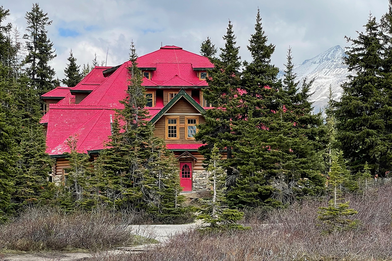
Even at the end of May, traces of winter linger on with snow on the mountains and ice along the shoreline. The red building way off to the right grabbed my attention, and I was hoping to get a closer look.
Wish Granted!
“Nestled on the shore of breathtaking Bow Lake, the iconic red roof of The Lodge has punctuated Alberta’s world-class natural scenery since 1922. Today, a group of new owners committed to the preservation of the property’s history and the surrounding environment have come together to refurbish the recognizable structure to its former glory, with attention to modern sustainability practices and deep respect for the history of the land itself.” ~ READ MORE
Another parking lot got us to another beautiful area with more lake views. The lodge was definitely in need of some TLC, but can you imagine how wonderful it will be to wake up in the morning to these views?
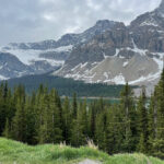
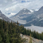
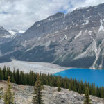
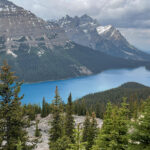
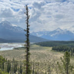
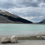
The Iconic Peyto Lake
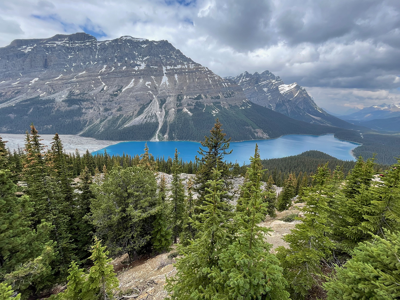 Supposedly the trail to the viewing platform at Peyto Lake (pronounced pea-toe) was an easy one, but it definitely was not. I trudged on, but stopped several times to catch my breath. Once I reached the viewing platforms, I was not prepared for the mind-blowing view that was before my eyes.
Now that I’m home, I read that there are two parking lots from which to choose. Further up the road is an upper lot for buses and folks who need a much easier route to the spectacular views. Jim would have benefitted from that knowledge at the time.
Peyto Lake is fed by the Peyto glacier and is 295 feet deep at its deepest point. Glacier water flows out of Peyto Lake to create the Mistaya River, which converges with the North Saskatchewan River at Saskatchewan Crossing – where we’re headed next. Click here for a winter-time photo that you won’t want to miss!
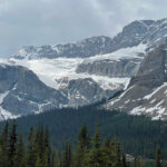
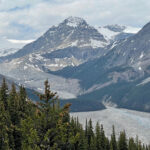
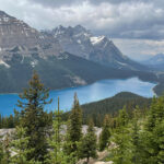
The Retreat of a Glacier
Today, this lake very clearly demonstrates the process of the creation of a glacial lake.
Peyto Glacier in Banff National Park is among the most closely monitored glaciers in the world. In 1968, the United Nations selected Peyto as a reference glacier for the International Hydrological Decade research initiative. Ever since, teams of scientists have traveled to the Canadian Rockies regularly to conduct field work and calculate changes in the mass of the glacier, providing the scientific community with a longer and more detailed data record for Peyto than most other glaciers.
In most years, Peyto has lost far more mass than it gained, according to data published by the World Glacier Monitoring Service. Experts say, Peyto lost about 70 percent of its mass during the past 50 years. ~ READ MORE
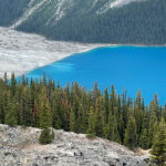
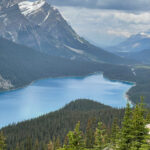
The Mixture
In the first photo, you can actually see the glacial silt mixing with the snowmelt, and this glorious shade of blue is the result. Sometimes the water seems more emerald, and on cloudy days or days with low sunlight to reflect the blue and green particles back to our eyes, the water may appear more grey – or milky.
Find your Zen at Saskatchewan Crossing
Saskatchewan Crossing is a tranquil place to gaze out at the immensity of life. With river and mountain views stretching as far as the eye can see, you can breathe in the clean, fresh air – and breathe out all of your woes. Interpretive historical displays follow the contours of the viewpoint and offer lots of history of the area. For a beautiful photo by Richard Wong when the river is running much fuller, click on the link.
The only source for gas, food, and lodging between Lake Louise and Jasper is Saskatchewan River Crossing which is close by, but make a note that it’s closed in the winter. We stopped and had an ice cream cone (a big one!).
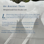
“The North Saskatchewan River rises in the Saskatchewan Glacier, an arm of the massive Columbia Icefield. The section of the river in Banff National Park flows swiftly past spectacular views of Rocky Mountain peaks. Native people hunted and camped along its shores for thousands of years before David Thompson, Joseph Howse, and later the Palliser Expedition explored the area.
With its tributary, the Howse River, it was briefly a major route for nineteenth century fur traders. Today. it provides a scenic recreational experience for skilled canoeists. For these outstanding features, the North Saskatchewan River in Banff National Park has been proclaimed a Canadian Heritage River.” ~ from a sign nearby
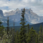
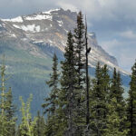
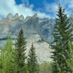
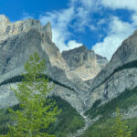
Random Views along the Parkway
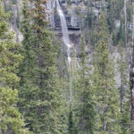
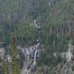
Bridal Veil Falls
This was one of those times when my lack of decision-making skills prompted a turn-around. We saw a really long falls that could have been seen from a pullout. I hemmed and hawed, and Jim passed it by. We ended up stopping at the next pullout for the first view below, but then I realized we needed to go back to see the long string of Bridal Veil Falls which drops… all the way… down the mountain. And I’m not even sure it was the end. That’s going to take a whole lotta bridesmaids to carry that veil!
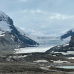
Athabasca Glacier
Athabasca Glacier is part of the Columbia Icefield and is one of the most visited glaciers in Canada. We were very excited about seeing this glacier, because of its sheer immensity, but we were pretty disappointed once we got here. The icefield was muddy and dirty – and a mere shadow of itself – not what I was expecting at all.
The other glaciers we’ve seen on this trip were far away and safe from the crowds, but this one was laid out for everyone to walk, drive Snow Cats, and take selfies on. I left with a sick feeling. We were planning on a short hike to get to the edge of it, but this was a rude awakening with a slap of reality.
The Columbia Icefield Discovery Centre is where you can book your excursions to crawl over the glacier, or see it from the Icefield Skywalk. Obviously, I’d vote for the latter.
And this is the point where we enter into Jasper National Park!
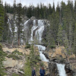
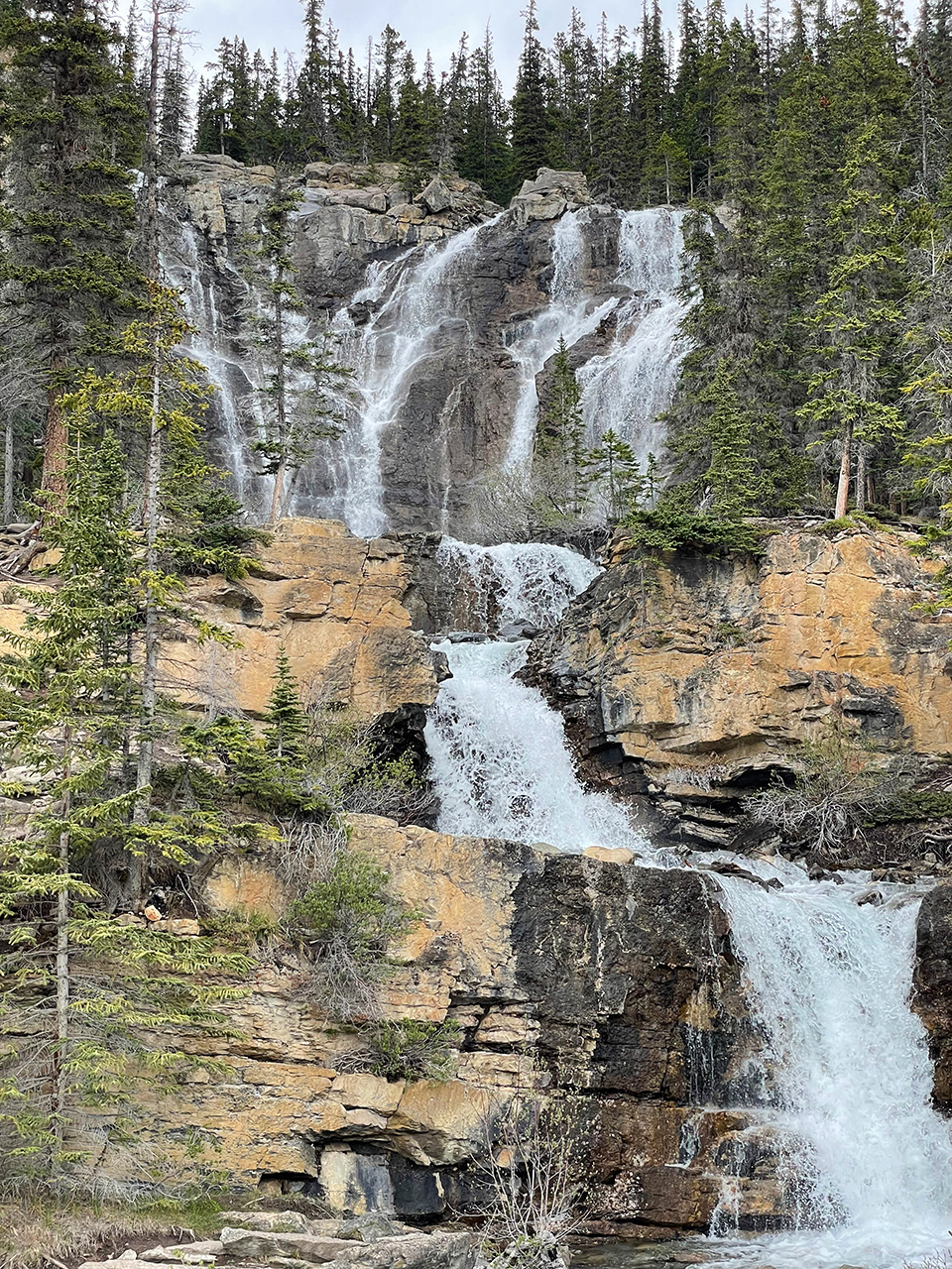
Tangle Creek Falls
These falls were a complete surprise, with a nice parking lot just across the road. If you’re into ice climbing, Tangle Creek Falls is one of many falls available to keep you busy! Visit the link for others.
All day, we’ve been amazed at how many gorgeous sights we’ve seen along the 144 miles of the Icefields Parkway. I hope that if you haven’t been here you’ll add it to your bucket list – although please don’t crawl all over the Athabasca Glacier. It’s having enough problems on its own. (IMHO)
Four More Days of Heaven!
Today we changed locations – from our beautiful (but small) condo in Canmore to a mountain cabin thirty miles north of the town of Jasper. Our unit at the Miette Mountain Cabins was not quite as inviting as the cabins looked on the website, but it was slightly more spacious than our condo in Canmore – except for the bathroom! It is what it is!
Next up: Maligne Canyon to Spirit Island
Happy trails,
Barb


